Get Autonomous Communities and Cities of Spain at a specified scale.
Source
https://gisco-services.ec.europa.eu/distribution/v2/.
Copyright: https://ec.europa.eu/eurostat/web/gisco/geodata/administrative-units.
Arguments
- ccaa
Character string. A vector of names, codes or both for Autonomous Communities and Cities, or
NULLto get all Autonomous Communities and Cities. See Details.- moveCAN
A logical
TRUE/FALSEor a vector of coordinatesc(lat, lon). It places the Canary Islands close to Spain's mainland. Initial position can be adjusted using the vector of coordinates. See Displacing the Canary Islands inesp_move_can().- ...
Arguments passed on to
esp_get_nutsyearYear character string or number. Release year of the file. See
giscoR::gisco_get_nuts()for valid values.epsgCharacter string or number. Projection of the map: 4-digit EPSG code. One of:
"4258": ETRS89."4326": WGS84."3035": ETRS89 / ETRS-LAEA."3857": Pseudo-Mercator.
cacheLogical. Whether to cache downloaded files. Defaults to
TRUE. See Caching.update_cacheLogical. If
TRUE, refreshes the cached file and forces a new download. Defaults toFALSE.cache_dirCharacter string. A path to a cache directory. See Caching.
spatialtypeCharacter string. Type of geometry to be returned. Options available are:
"RG": regions, returned as aMULTIPOLYGON/POLYGONobject."LB": labels, returned as aPOINTobject.
extCharacter. Extension of the file (default
"gpkg"). SeegiscoR::gisco_get_nuts().verboseA logical value. If
TRUEdisplays informational messages.resolutionA character string or numeric value with the geospatial data resolution. One of:
"60": 1:60 million."20": 1:20 million."10": 1:10 million."03": 1:3 million."01": 1:1 million.
Value
A sf object.
Details
When using ccaa you can use and mix names and NUTS codes (levels 1 or 2),
ISO codes (corresponding to level 2) or codauto (see esp_codelist).
Ceuta and Melilla are included at the Autonomous Communities and Cities
level in this function.
When calling a NUTS 1 level, all Autonomous Communities and Cities of that level are added.
Caching
Functions that download data store files in cache_dir. When cache_dir
is NULL, they use the active package cache, which defaults to a temporary
directory. Set update_cache = TRUE to replace an existing cached file.
See Caching strategies in esp_set_cache_dir() to configure a
persistent cache.
See also
GISCO boundary data:
esp_get_munic(),
esp_get_nuts(),
esp_get_prov(),
esp_get_spain()
Examples
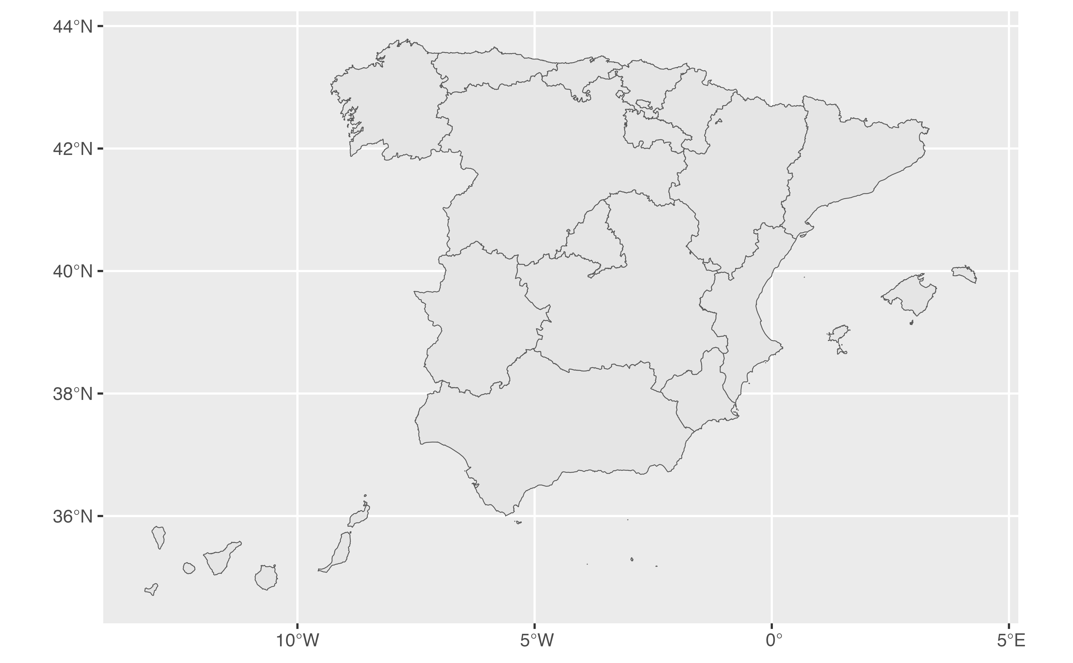
ccaa <- esp_get_ccaa()
library(ggplot2)
ggplot(ccaa) +
geom_sf()
 # Random Autonomous Communities and Cities.
random_ccaa <- esp_get_ccaa(ccaa = c(
"Euskadi",
"Catalunya",
"ES-EX",
"Canarias",
"ES52",
"01"
))
ggplot(random_ccaa) +
geom_sf(aes(fill = codauto), show.legend = FALSE) +
geom_sf_label(aes(label = codauto), alpha = 0.3) +
coord_sf(crs = 3857)
# Random Autonomous Communities and Cities.
random_ccaa <- esp_get_ccaa(ccaa = c(
"Euskadi",
"Catalunya",
"ES-EX",
"Canarias",
"ES52",
"01"
))
ggplot(random_ccaa) +
geom_sf(aes(fill = codauto), show.legend = FALSE) +
geom_sf_label(aes(label = codauto), alpha = 0.3) +
coord_sf(crs = 3857)
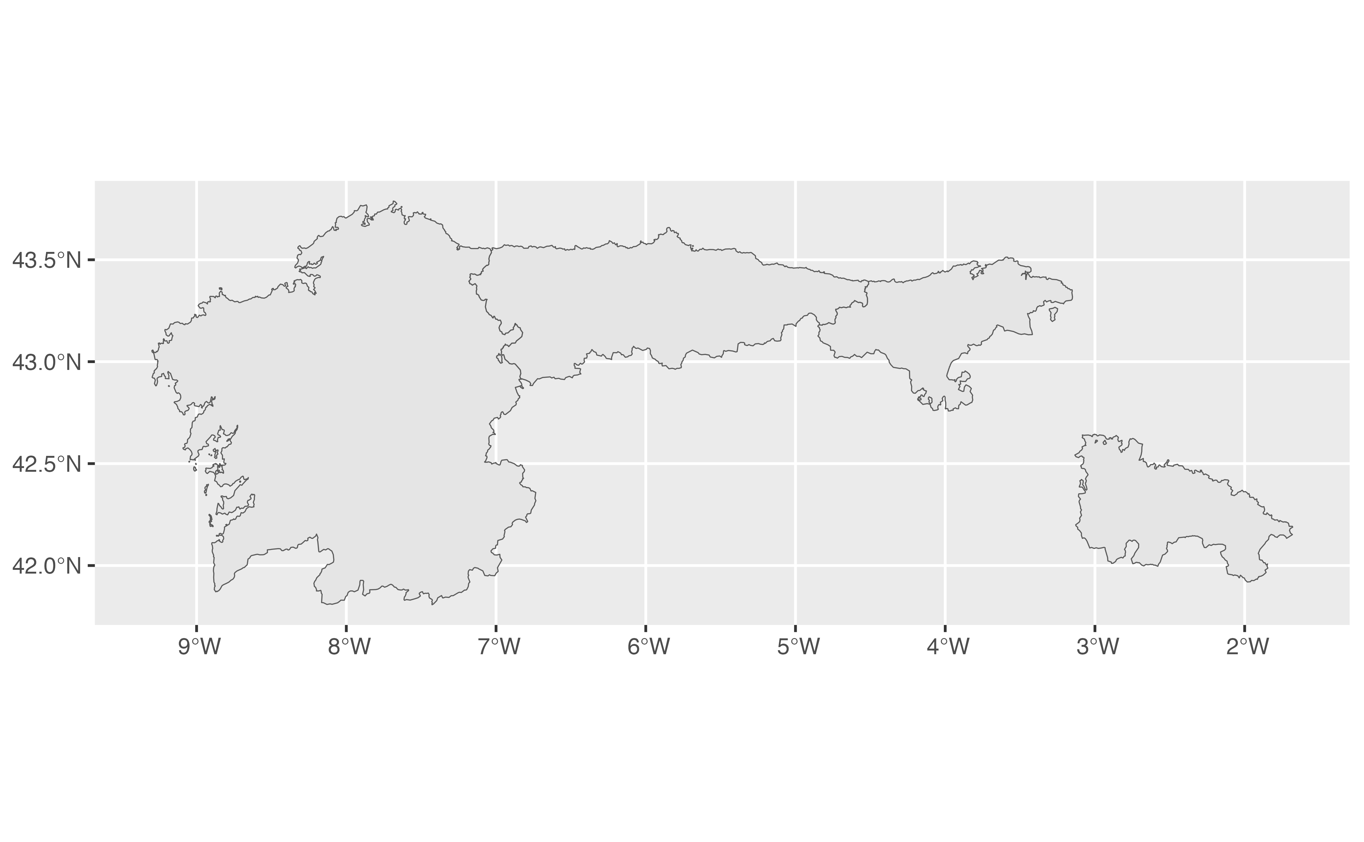
 # All Autonomous Communities and Cities of a NUTS 1 region plus one.
mixed <- esp_get_ccaa(ccaa = c("La Rioja", "Noroeste"))
ggplot(mixed) +
geom_sf()
# All Autonomous Communities and Cities of a NUTS 1 region plus one.
mixed <- esp_get_ccaa(ccaa = c("La Rioja", "Noroeste"))
ggplot(mixed) +
geom_sf()
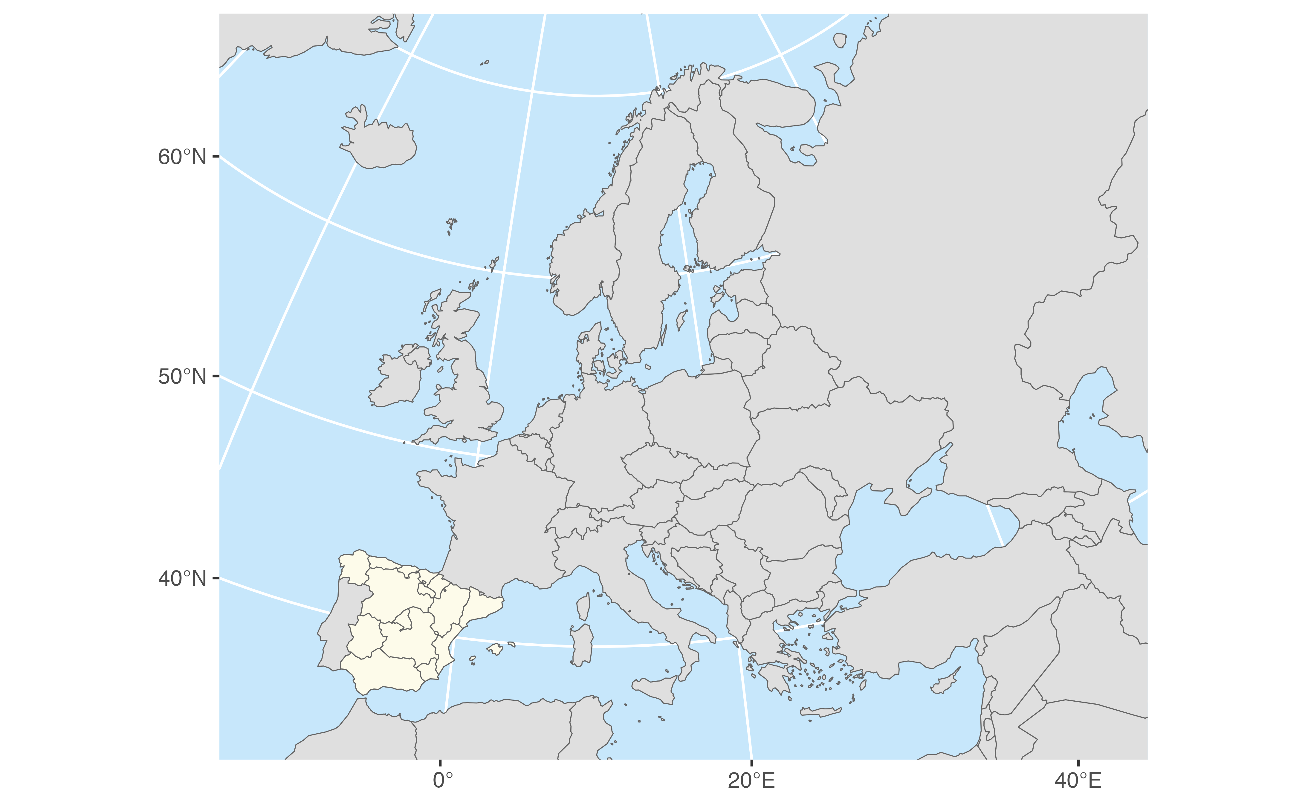
 # Combine with giscoR to get countries.
# \donttest{
library(giscoR)
library(sf)
#> Linking to GEOS 3.12.1, GDAL 3.8.4, PROJ 9.4.0; sf_use_s2() is TRUE
res <- 20 # Use the same resolution.
europe <- gisco_get_countries(resolution = res)
ccaa <- esp_get_ccaa(moveCAN = FALSE, resolution = res)
ggplot(europe) +
geom_sf(fill = "#DFDFDF", color = "#656565") +
geom_sf(data = ccaa, fill = "#FDFBEA", color = "#656565") +
coord_sf(
xlim = c(23, 74) * 10e4,
ylim = c(14, 55) * 10e4,
crs = 3035
) +
theme(panel.background = element_rect(fill = "#C7E7FB"))
# Combine with giscoR to get countries.
# \donttest{
library(giscoR)
library(sf)
#> Linking to GEOS 3.12.1, GDAL 3.8.4, PROJ 9.4.0; sf_use_s2() is TRUE
res <- 20 # Use the same resolution.
europe <- gisco_get_countries(resolution = res)
ccaa <- esp_get_ccaa(moveCAN = FALSE, resolution = res)
ggplot(europe) +
geom_sf(fill = "#DFDFDF", color = "#656565") +
geom_sf(data = ccaa, fill = "#FDFBEA", color = "#656565") +
coord_sf(
xlim = c(23, 74) * 10e4,
ylim = c(14, 55) * 10e4,
crs = 3035
) +
theme(panel.background = element_rect(fill = "#C7E7FB"))
 # }
# }