National geographic grids from BDN (Nature Data Bank)
Source:R/esp-get-grid-BDN.R
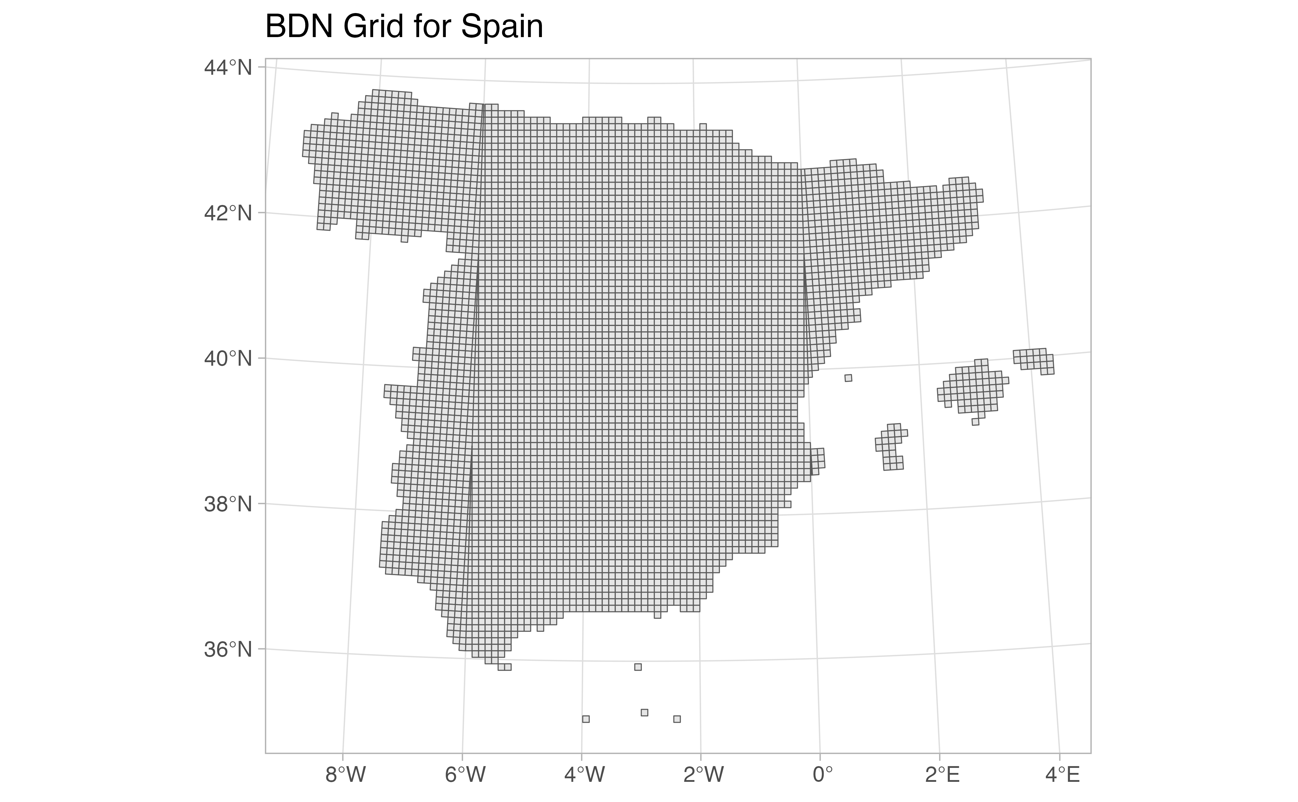
esp_get_grid_BDN.RdThis function loads an sf POLYGON object with the
geographic grids of Spain provided by the Banco de Datos de la Naturaleza
(Nature Data Bank), under the Ministry of Environment (MITECO).
This dataset provides two accessors. esp_get_grid_BDN() extracts
country-wide regular grids with resolutions of 5 x 5 or 10 x 10 kilometers
for mainland Spain or the Canary Islands. esp_get_grid_BDN_ccaa() extracts
1 x 1 kilometer resolution grids for individual Autonomous Communities and
Cities.
These grids are useful for biodiversity analysis, environmental monitoring, and spatial statistical applications.
esp_get_grid_BDN_ccaa() provides higher-resolution 1 x 1 kilometer grids
for specific Autonomous Communities and Cities, useful for regional analysis
with finer spatial detail.
Source
Data sourced from the Banco de Datos de la Naturaleza (BDN). See the repository structure: https://github.com/rOpenSpain/mapSpain/tree/sianedata/MITECO/dist
For more information about BDN grids and other resources, visit: https://www.miteco.gob.es/es/biodiversidad/servicios/banco-datos-naturaleza/informacion-disponible/bdn-cart-aux-descargas-ccaa.html.
Arguments
- resolution
Numeric. Resolution of the grid in kilometers. Must be one of:
5: 5 x 5 kilometer cells.10: 10 x 10 kilometer cells (default).
- type
Character. The geographic scope of the grid:
"main": Mainland Spain (default)."canary": Canary Islands.
- update_cache
Logical. If
TRUE, refreshes the cached file and forces a new download. Defaults toFALSE.- cache_dir
Character string. A path to a cache directory. See Caching.
- verbose
A logical value. If
TRUEdisplays informational messages.- ccaa
Character string. A vector of names, codes or both for Autonomous Communities and Cities. See Details on
esp_get_ccaa()for accepted formats.
Value
An sf POLYGON object.
Details
The BDN provides standardized geographic grids for Spain that follow the
Nature Data Bank's specifications. The data are downloaded from the
sianedata/MITECO/dist data branch and are regularly updated.
Caching
Functions that download data store files in cache_dir. When cache_dir
is NULL, they use the active package cache, which defaults to a temporary
directory. Set update_cache = TRUE to replace an existing cached file.
See Caching strategies in esp_set_cache_dir() to configure a
persistent cache.
See also
Geographic grid data:
esp_get_grid_ESDAC(),
esp_get_grid_MTN()