Get sf POLYGON or LINESTRING of rivers, channels and other wetlands of Spain
Source: R/esp_get_rivers.R
esp_get_rivers.RdLoads a sf POLYGON or LINESTRING object representing
rivers, channels, reservoirs and other wetlands of Spain.
Usage
esp_get_rivers(
  epsg = "4258",
  cache = TRUE,
  update_cache = FALSE,
  cache_dir = NULL,
  verbose = FALSE,
  resolution = "3",
  spatialtype = "line",
  name = NULL
)
Source
IGN data via a custom CDN (see https://github.com/rOpenSpain/mapSpain/tree/sianedata).
Arguments
- epsg
projection of the map: 4-digit EPSG code. One of:
"4258": ETRS89."4326": WGS84."3035": ETRS89 / ETRS-LAEA."3857": Pseudo-Mercator.
- cache
A logical whether to do caching. Default is
TRUE. See About caching.- update_cache
A logical whether to update cache. Default is
FALSE. When set toTRUEit would force a fresh download of the source file.- cache_dir
A path to a cache directory. See About caching.
- verbose
Logical, displays information. Useful for debugging, default is
FALSE.- resolution
Resolution of the
POLYGON. Values available are"3","6.5"or"10".- spatialtype
Spatial type of the output. Use
"area"forPOLYGONor"line"forLINESTRING.- name
Optional. A character or
regexexpression with the name of the element(s) to be extracted.
Value
A sf POLYGON or LINESTRING object.
Details
Metadata available on https://github.com/rOpenSpain/mapSpain/tree/sianedata/.
See also
Other natural:
esp_get_hydrobasin(),
esp_get_hypsobath()
Examples
# \donttest{
# Use of regex
regex1 <- esp_get_rivers(name = "Tajo|Segura")
unique(regex1$rotulo)
#> [1] "Río Tajo" "Río Segura"
#> [3] "Canal del Transvase Tajo-Segura"
regex2 <- esp_get_rivers(name = "Tajo$| Segura")
unique(regex2$rotulo)
#> [1] "Río Tajo" "Río Segura"
# See the diference
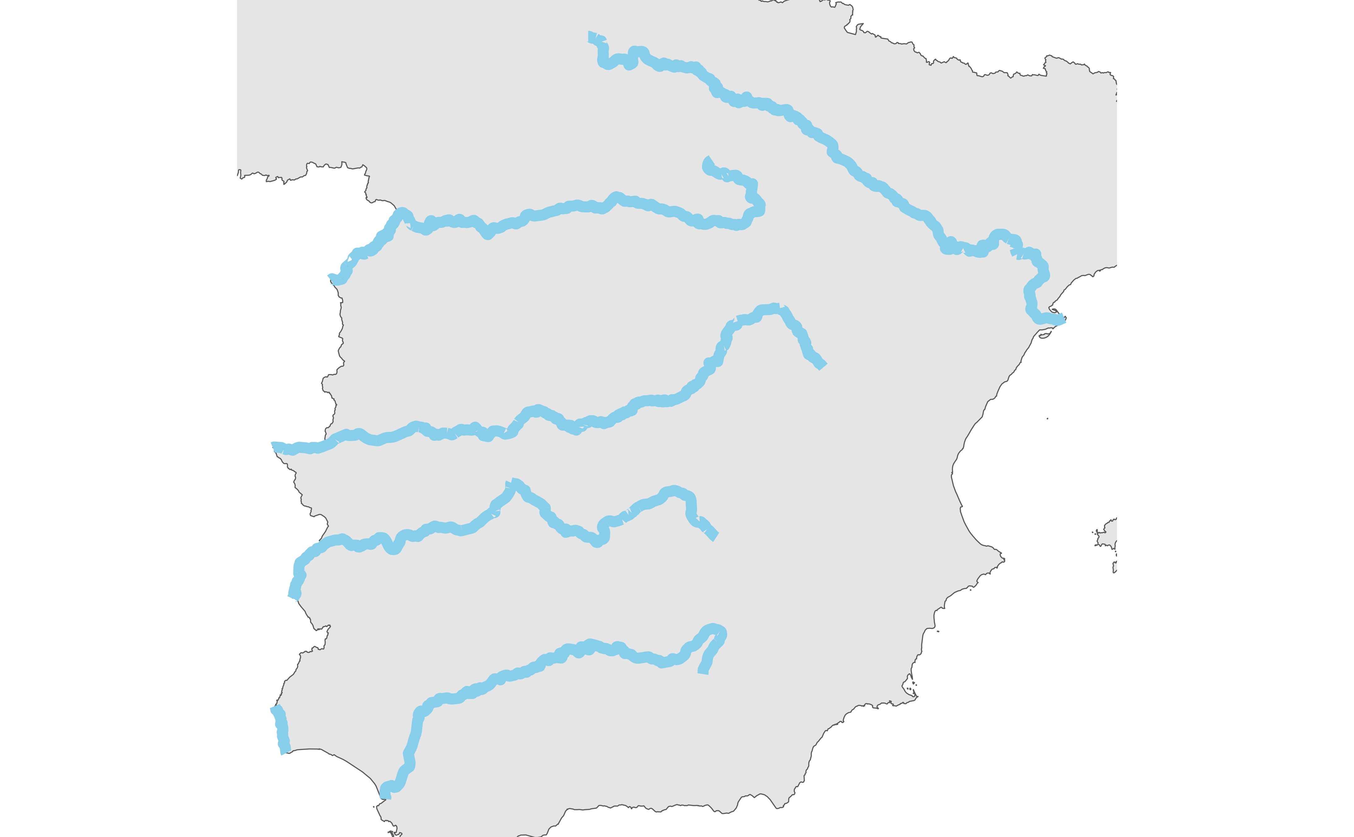
# Rivers in Spain
shapeEsp <- esp_get_country(moveCAN = FALSE)
MainRivers <-
esp_get_rivers(name = "Tajo$|Ebro$|Ebre$|Duero|Guadiana$|Guadalquivir")
sf::st_bbox(MainRivers)
#> xmin ymin xmax ymax
#> -7.545006 36.798737 0.863511 43.014104
library(ggplot2)
ggplot(shapeEsp) +
geom_sf() +
geom_sf(data = MainRivers, color = "skyblue", linewidth = 2) +
coord_sf(
xlim = c(-7.5, 1),
ylim = c(36.8, 43)
) +
theme_void()
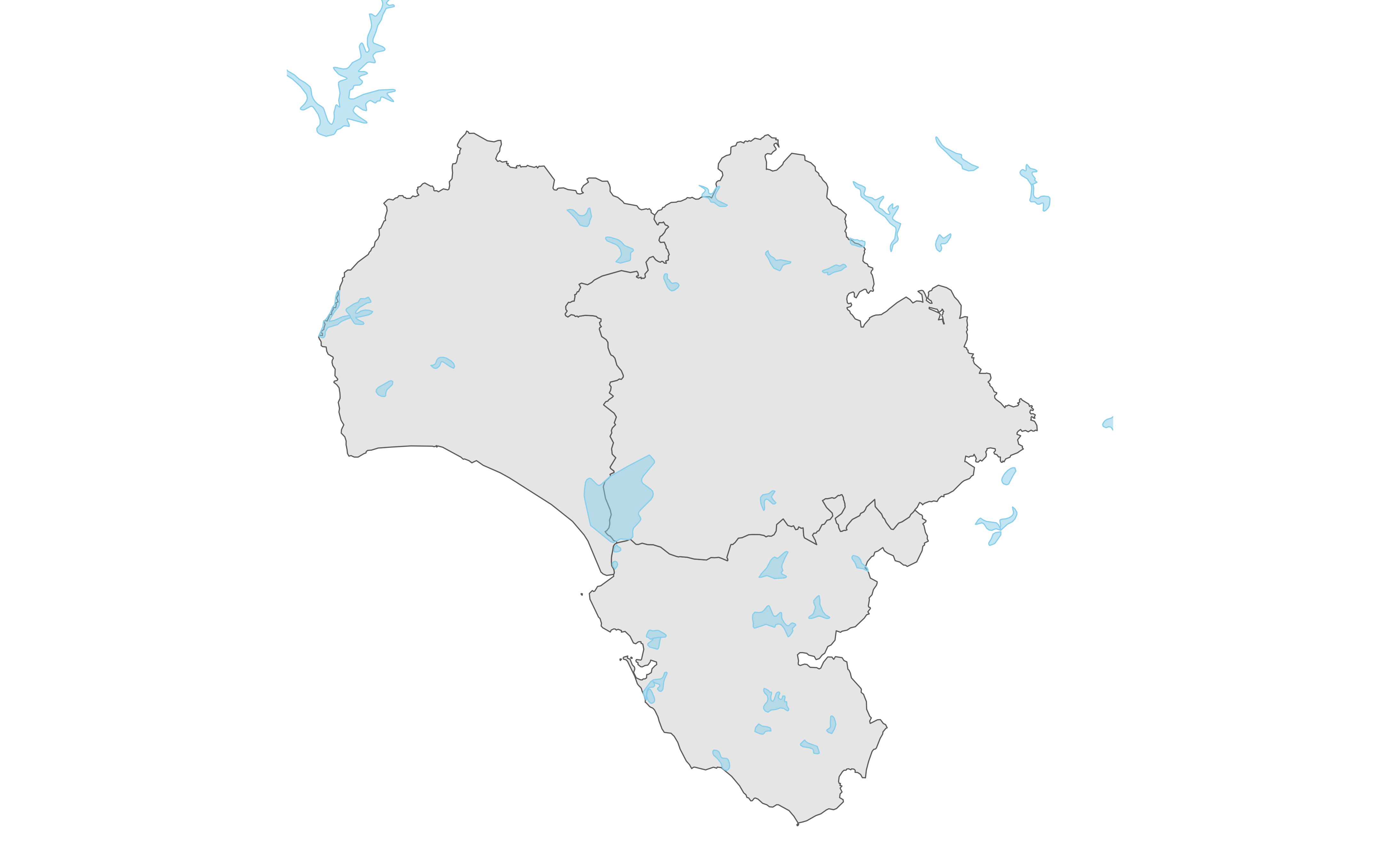
 # Wetlands in South-West Andalucia
and <- esp_get_prov(c("Huelva", "Sevilla", "Cadiz"))
Wetlands <- esp_get_rivers(spatialtype = "area")
ggplot(and) +
geom_sf() +
geom_sf(
data = Wetlands, fill = "skyblue",
color = "skyblue", alpha = 0.5
) +
coord_sf(
xlim = c(-7.5, -4.5),
ylim = c(36, 38.5)
) +
theme_void()
# Wetlands in South-West Andalucia
and <- esp_get_prov(c("Huelva", "Sevilla", "Cadiz"))
Wetlands <- esp_get_rivers(spatialtype = "area")
ggplot(and) +
geom_sf() +
geom_sf(
data = Wetlands, fill = "skyblue",
color = "skyblue", alpha = 0.5
) +
coord_sf(
xlim = c(-7.5, -4.5),
ylim = c(36, 38.5)
) +
theme_void()
 # }
# }